V.N. Sukachev Institute of Forest  
Laboratory of Ecophysiology of Permafrost Systems  


About our project

Work packages

Staff

Field sites

Equipment

Activities

Publications

Contact

WP 1. Assessment and monitoring of vegetation

WP Team:

  • Mikhail A. Korets (PhD, Senior Researcher) – PI, GIS, Remote sensing
  • Vera A. Ryzhkova (PhD, Senior Researcher) – Geobotany
  • Irina V. Danilova (PhD, Junior Researcher) – GIS, Remote sensing
  • Irina A. Mikhailova (Junior Researcher) – Cartography
  • Konstantin V. Yakovlev (Senior Research Assistant) – IT support

WP objectives:

WP 1.1. Development of the GIS-based database, including:

  • Topographic base and DEM
  • EO data based products
  • Thematic maps (VCF, soil, landscape, eco-regions)
  • Climate database (CRU, MERRA NEESPI-ArcticRIMS-ES Atlas)
  • In-situ data samples (forest inventory and field sites):
    Forest cover, soil and permafrost characteristics

WP 1.2. The objective is to design a combined approach to support a regional vegetation / forest observation system including analysis of landcover types and biomass volume dynamics

  • Classification and inventory of the current diversity of forest ecosystems
  • Development of automated technique of vegetation cover mapping based on GIS-technology
  • Estimation of the current state, trends, and rates of forest succession for a range of site conditions

WP 1.1. Development of the GIS-based database

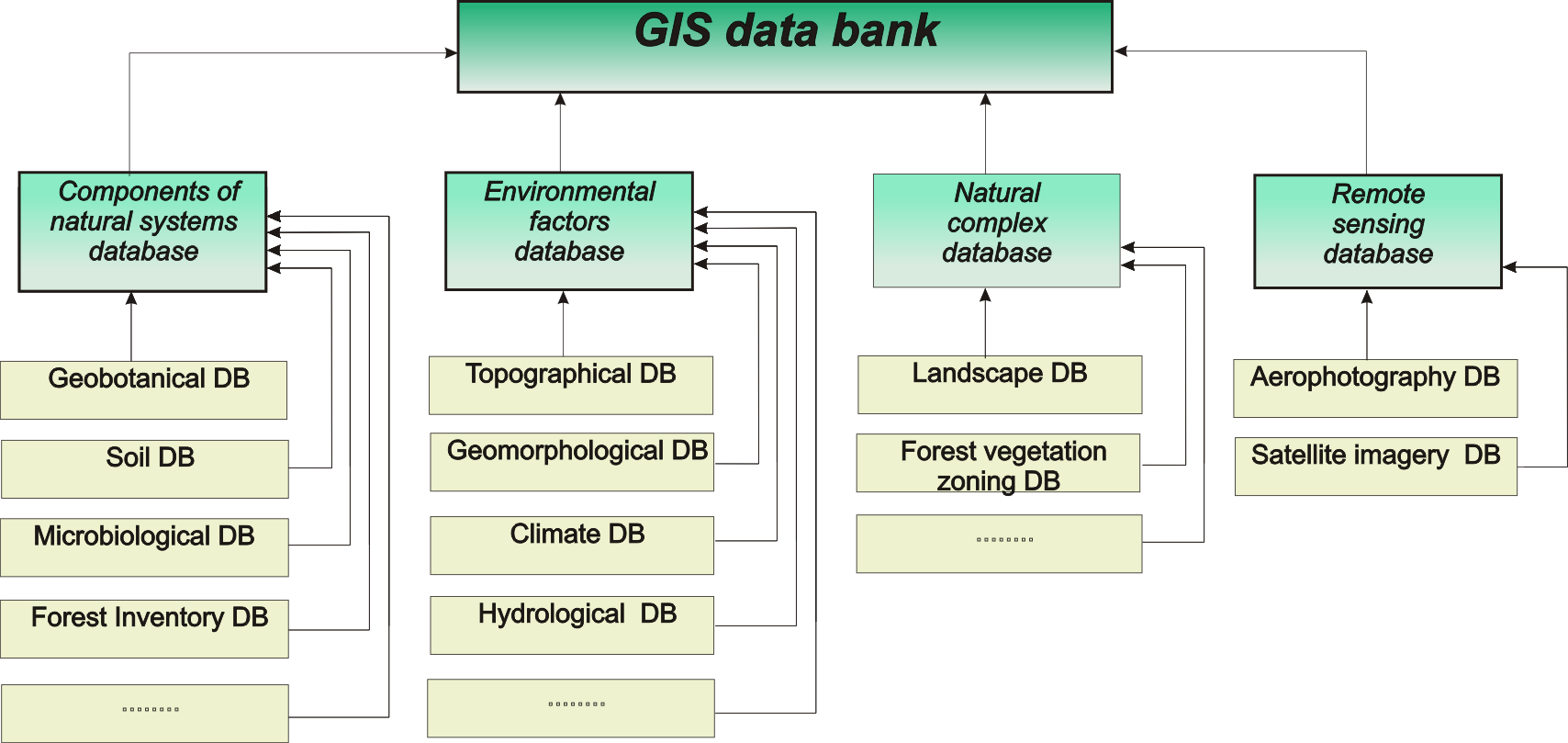
GIS User Interface based on ESRI ArcGIS platform

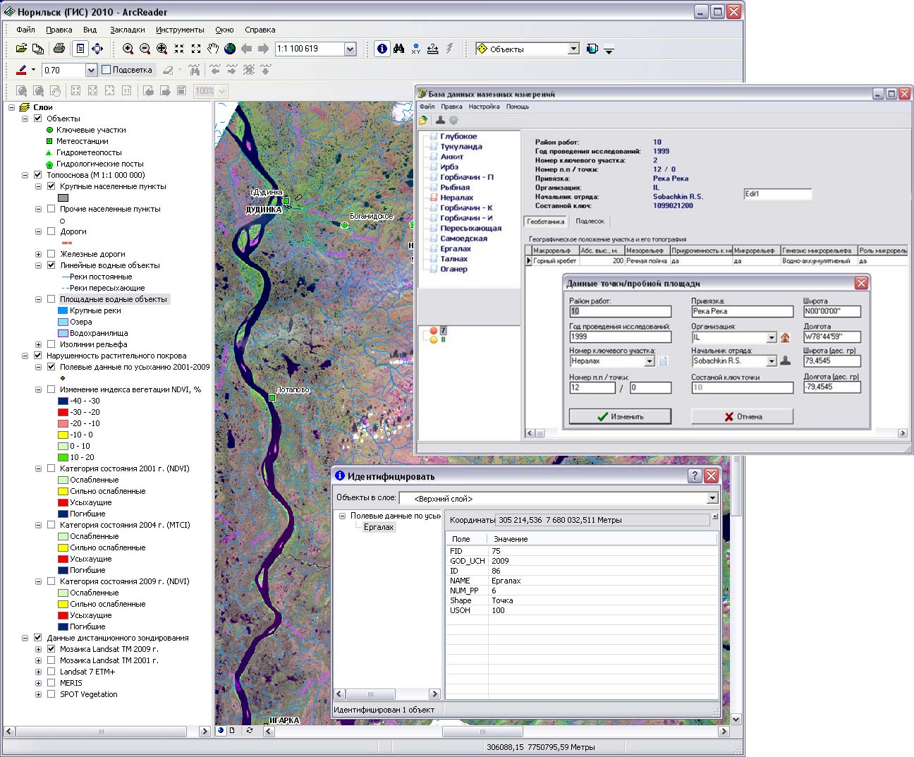
Data formats and software

Raster and Vector GIS layers on the base of

  • ESRI Personal geodatabase and shape-files
     - vector data classes
     - attributive data tables
     - topology
     - raster catalogues for EO data
  • ESRI GRID and ERDAS Imagine Raster Format
  • ESRI Metadata format and ISO 9115

Software for implementation

  • ESRI ArcGIS 10 (Spatial Annalist, 3D Annalist, Geostatistic)
  • ERDAS Imagine 2013
  • eCognition Developer 8
  • Microsoft Access

WP 1.2. A combined approach to support a regional vegetation / forest observation system including analysis of landcover types and biomass volume dynamics

Vegetation mapping
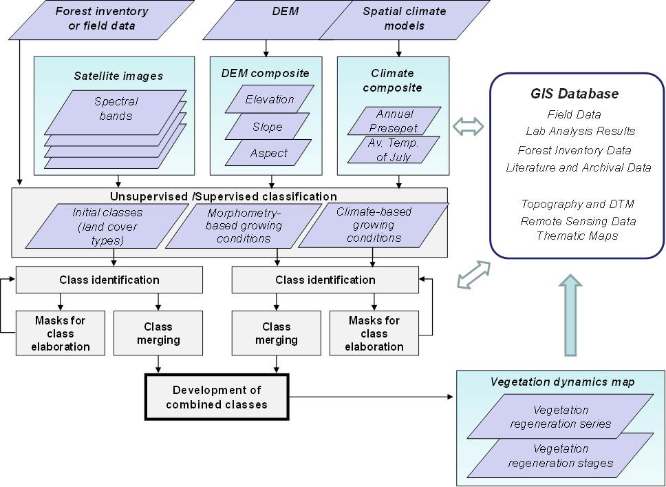